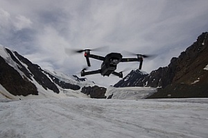
A group of Tomsk State University geographers has developed a new method for studying the process of melting glaciers. Scientists use unmanned aerial vehicles to obtain information on the nature and dynamics of change. On the basis of aerial photography materials, geographers, using special software, build detailed maps and three-dimensional models of the retreating glacier tongues of the Waterfall, Big and Small Aktru glaciers, located in the Altai Mountains.
- Research in the highlands is complex and interesting at the same time, because this is where the fastest landscape response to climate change takes place, - said Alexander Erofeev, the head of the research project, Associate Professor at the TSU Faculty of Geology and Geography. - One of the main indicators of global environmental transformation is the melting of glaciers. We are observing several large objects that are located in the mountains of Altai - the Waterfall, Big and Small Aktru glaciers. The rate of melting of the latter is very high. Over the year, it retreats tens of meters, in the near future, the Small Aktru can put on an anti-record and retreat a hundred meters or more.
Previously, scientists measured the planned-high-altitude position of glacier tongues with geodetic instruments and noted the boundaries of vanishing ice with reference stones. Now they do it with the help of digital technologies that allow them to get much more diverse information. Three-dimensional models built on the basis of aerial photography reflect the irregularities of the relief of the glacier tongue with their accurate geo-referencing. Comparison of such data obtained in different years will allow us to reveal the dynamics of changes in the volume of the ice sheet.
The feature of the TSU geographers’ studies is that they are conducted in difficult orographic and meteorological conditions. Aerial photography in the highlands is complicated by the nature of the terrain and unpredictable and often extreme weather conditions (wind, rain, and temperature fluctuations). This requires experience and special qualification of the UAV operator because expensive equipment is easy to break or lose in the mountains.
According to Alexander Erofeev, the development of a new technique is carried out by the method of numerous tests. Now scientists are analyzing a large array of information collected on glaciers with the help of drones in the summer of 2018. Recently, a researcher from the University of South Africa, David William Hedding, a specialist in glacial geomorphology, joined these studies.
- In July of this year, I’ve visited Aktru for the first time, came to the 5th International Summer School, organized by TSU and devoted to the study of transformations that occur in the Arctic and Siberia,- says David William Hedding. - I do research in the Sub-Antarctic. I was very interested in the project and methodology of my TSU colleagues. It turned out that we use similar approaches to assessing the melting of glaciers, which makes it possible to carry out a comparative analysis of the results that we obtain by studying glaciers in different hemispheres of the Earth. Our collaboration provided much more interesting data.
According to researchers, the melting of glaciers is not only an indicator of climate change, but also a starting point for new natural disasters: rising sea levels, changes in water temperature, and salt concentrations in the seas. The technique developed by geographers of TSU allows predicting the future behavior of glaciers.

